Monitoring
What can we do to further the general understanding of ocean processes and the role of the ocean in CO2 uptake?
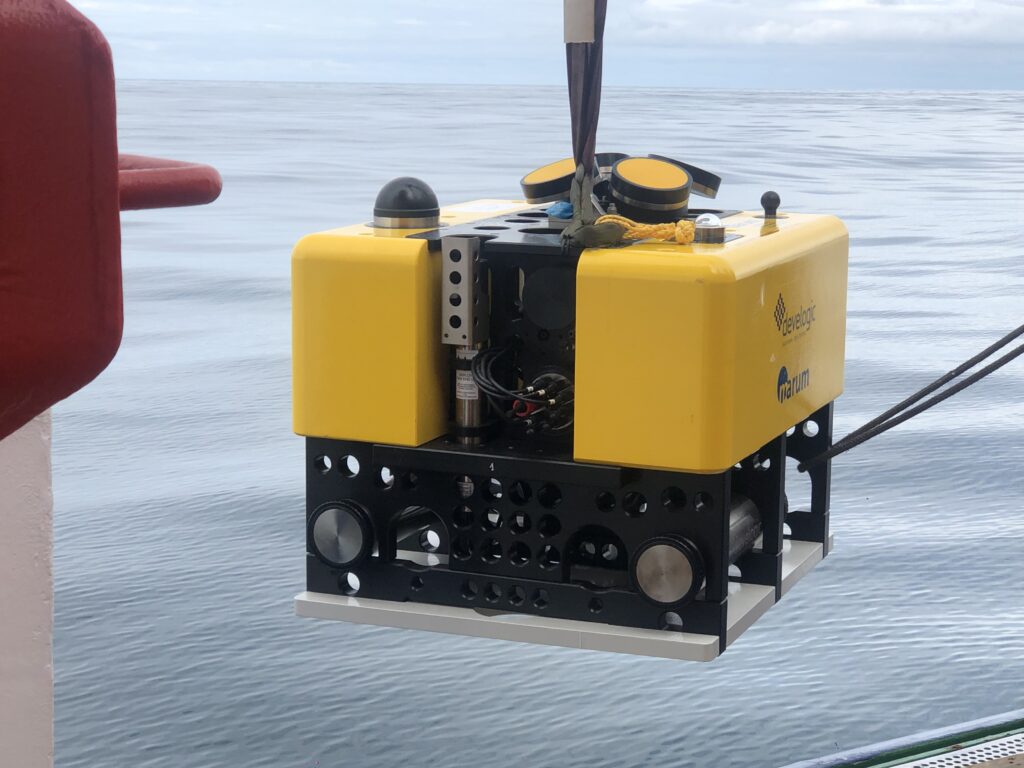
The ocean accounts for 71% of the surface area and 98% of the habitable volume (the so-called “inner space”) on our planet. Monitoring is therefore inevitably patchy, both spatially and temporally. Since observing systems are expensive and suffer in salt water and at high pressures and low temperatures, low-cost, robust. Sensors and instruments. Developed that can be deployed in greater numbers in the future.
For questions on climate change and CO2 processes, carbonate system sensors are needed in large numbers because they best map climate changes. These include parameters such as pH, DIC (dissolved inorganic carbon), pCO2, as developed in AIMS3. In particular, joint developments as a cooperation between science and small and medium-sized, innovative companies seem to make sense as a step towards technology transfer.
What techniques are needed for environmental monitoring?
In order to explore the gigantic volume of the ocean, platforms are needed at the sea surface (wave gliders, drifters), in the body of water (gliders, floats) and on the seabed (moorings, landers). There is a need for small, robust and cost-effective designs in order to multiply the number of platforms. Marine robotics and artificial intelligence can be used to spatially extend monitoring.
It is important in the context of carbon dioxide extraction to record environmental changes caused by CCS or other human actions. Especially in the case of underground injection of CO2, such monitoring is essential in order to locate leaks if necessary, to detect local acidification at an early stage, and to operate warning systems if necessary. In AIMS3, such systems are being built or optimised in order to be prepared for later injection.
Can CO2 dispersion in the subsurface be made visible?
The dispersion of CO2 in the storage formation can be tracked using geophysical methods. This approach has already been successfully applied to CO2 storage in the Norwegian North Sea (Sleipner project). The GEOSTOR project is therefore developing a new environmentally friendly and minimally invasive method to use OBS to track CO2 dispersion and detect changes in the subsurface at an early stage. The detected microseismic events may be due to pressure changes, fluid shifts, pore fluid saturation, reactivation of fractures and filtration channels.
The AIMS3 project, on the other hand, does not need to image the spreading, but tries to show how much of the injected CO2 is directly sequestered and if anything escapes by monitoring the carbonate system. Based on results from Carbfix (www.carbfix.com), where the same method is applied shallow off Iceland, 95% or more can be directly deposited mineral in the ocean crust and permanently bound.
How can the large amount of continuously recorded data be processed and curated?
Automated and optimised interpretation of the data is a prerequisite for an industrially scalable and socially acceptable monitoring system (monitoring, measurement and verification) of CO2 sequestration in offshore storage sites. The amount of data generated is increasing over time, especially for long-term projects and with the increasing number of CCS projects planned worldwide to achieve the net-zero target and mitigate climate change. These growing volumes of data need to be processed efficiently to ensure timely interpretation of the data and thus reduce the risks associated with CO2 storage. For this purpose, the DAM mission CDRmare has an elaborate data management system in place.